GREENSBORO, N.C. — It seems that we can't get a break from all the rain lately and we're headed for even more as an unsettled weather pattern sets in for the second half of the week.
The WFMY News 2 Weather team is keeping a close watch on a low-pressure system that is bringing heavy rain and a few strong storms to the Piedmont Triad this evening.
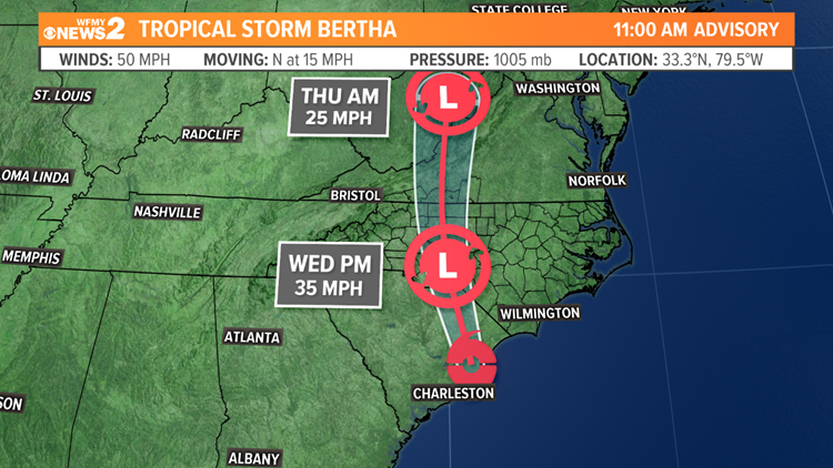
This area of low pressure strengthened into Tropical Storm Bertha this morning but has since weakened to a tropical depression. .

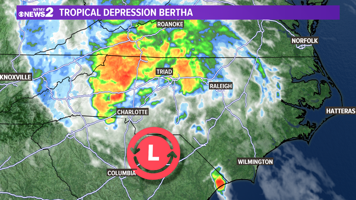
While Bertha has been downgraded to a tropical depression, our impacts here in the Piedmont Triad haven't changed -- heavy rain at times, possible flash flooding, and a low-end severe weather threat. We will also need to watch wind gusts as the remnant low moves over us this evening. Wind gusts of 35-40 mph could bring some trees down.
Flooding Threat

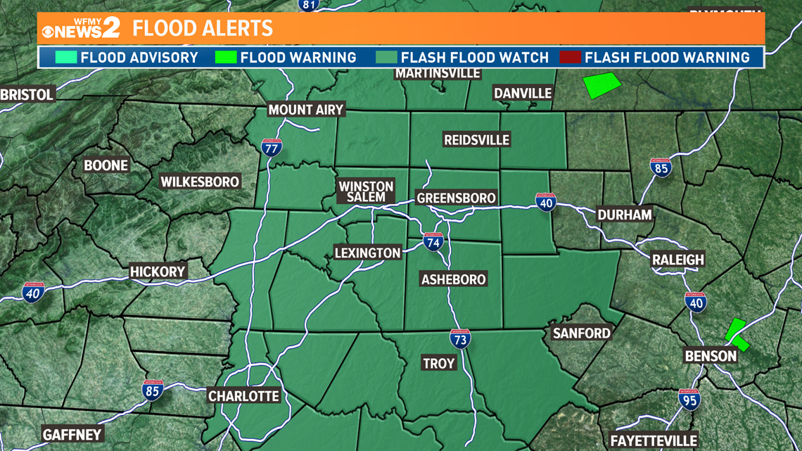
With ample amounts of tropical moisture, it will bring a soaking to the Piedmont Triad. 1-2" of rain will be possible with this system, which could cause flash flooding in spots. Stay weather aware Wednesday evening -- especially if you live in a flood prone area.
**A FLASH FLOOD WATCH IS IN EFFECT FOR WEDNESDAY AFTERNOON AND EVENING**

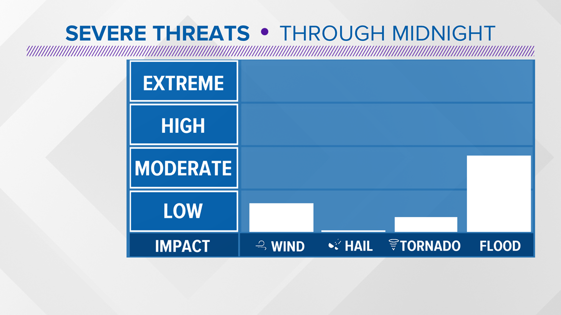
Severe Weather Threat
In addition to the flooding risk, a tornado or two can't be ruled out as the low tracks right over us. We'll also have to watch out for a few wind gusts that may topple some trees. With the ground so saturated, the wind won't have to be all that strong to knock a tree over. The window for the possibility of severe storms will come to an end by midnight. We'll keep an eye on radar for you.

TIMELINE:
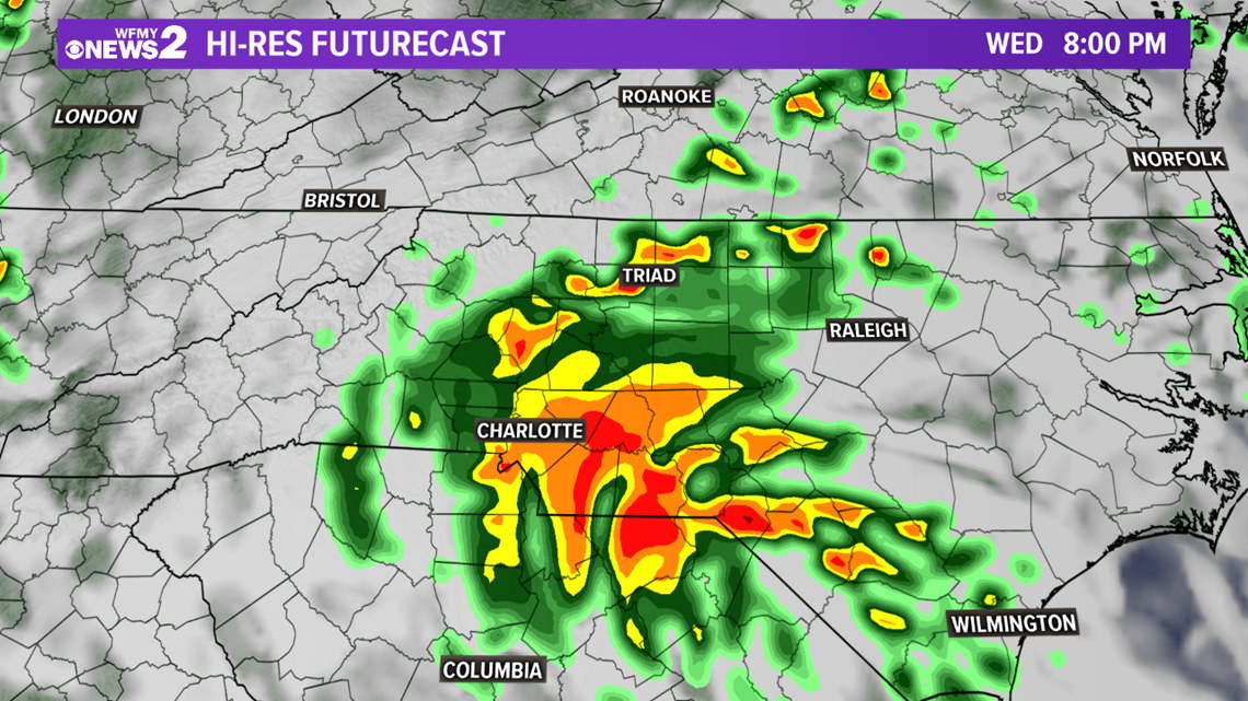
Wednesday 5 PM - Thursday 12 AM: Rain, likely heavy at times, a few storms. Flash Flooding possible under heavy rain bands.
Thursday: Low pressure moves away leaving clouds, a few showers, chance for afternoon storms.

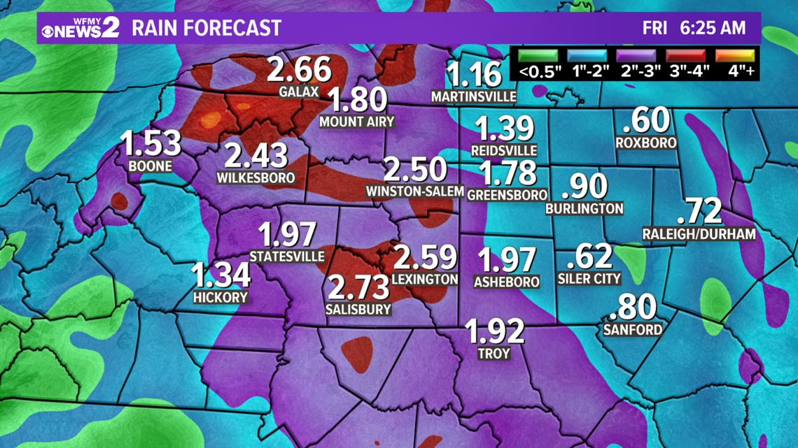
The system will be fueled with ample amounts of moisture which over the course of Wednesday and Thursday could bring the Piedmont Triad between 1"-2" of rain, with the highest totals where heavy bands set up.
The Triad has already picked up 7.5" inches of rain recently, most of it coming last week, and with the ground already saturated, we have a significant flash flooding risk Wednesday into Thursday, especially in flood prone areas.

Make sure to stay weather aware and never drive through flooded roads. The WFMY Weather team will keep you up to date.