GREENSBORO, N.C. — That didn't last long. A quick two-day break from rain comes to an end on our Wednesday. A soaking day lies ahead with a large amount of rain moving into the Carolinas through the afternoon. A few thunderstorms may be possible in spots as well. As always, our WFMY News 2 Weather team is on top of it.
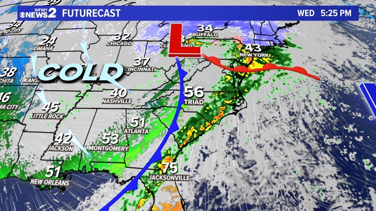
Rain is building over the Piedmont this morning. This happens as low pressure is moving our way from the Gulf Coast. This system brought soaking rain and severe storms to places like Lousiana, Texas, and Mississippi on Tuesday. Now, we'll see a chilly rain settle in and stick around for the morning hours. Much of this will be moderate, but it could be heavy at times as well.
Warm air will be trying to move in throughout the day as the rain continues, but it will have a hard time pushing out the chilly air. Areas north and west of Greensboro will stay cool, with high temperatures in the 40s. Areas south and east will get warmer, even into the 50s and 60s by the afternoon. It's these areas that may have a risk of a few thunderstorms during the afternoon hours.
Rain will continue through the midday and afternoon hours, moderate to heavy at times. Be on the lookout for ponding of water on the roads. Winds will be gusty as well, occasionally gusting between 20 and 30 mph.
The rain will come to an end around the time of the evening commute, between 4 and 6pm. It will be breezy and turn sharply colder toward nightfall.
TIMELINE:
Rain will be with us a good chunk of the day Wednesday. Here's a general timeline.
- Morning commute: Rain begins, light to moderate, chilly
- Midday: Rain continues, moderate to heavy, temps warming
- Afternoon: Rain continues, moderate to heavy. Few thunderstorms possible south and east
- Evening: Rain ends. Temps drop
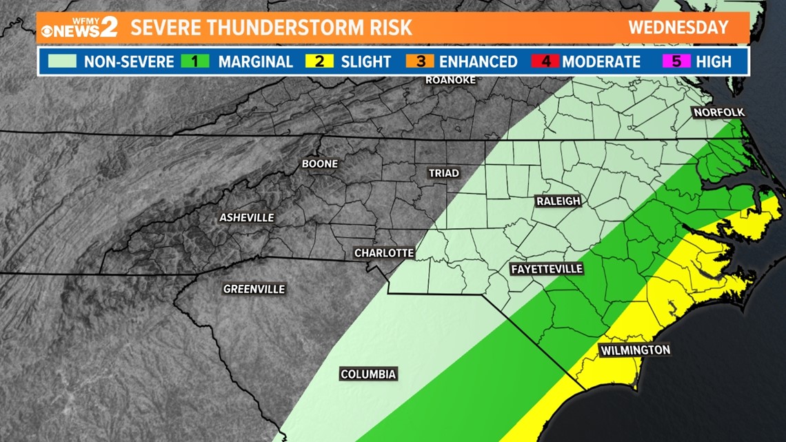
ANY THUNDERSTORMS?
There will be a risk of strong to severe thunderstorms in parts of North Carolina on Wednesday as warm air moves in ahead of the system.
Here in the Piedmont we're going to be on the edge of that. Cool air hanging onto our area a little longer should prevent many storms around here, but we still do have a low chance for areas south and east of Greensboro. We'll keep an eye on it for you throughout the day.
The main concern in any thunderstorms would be for a damaging wind gust and heavy rain.

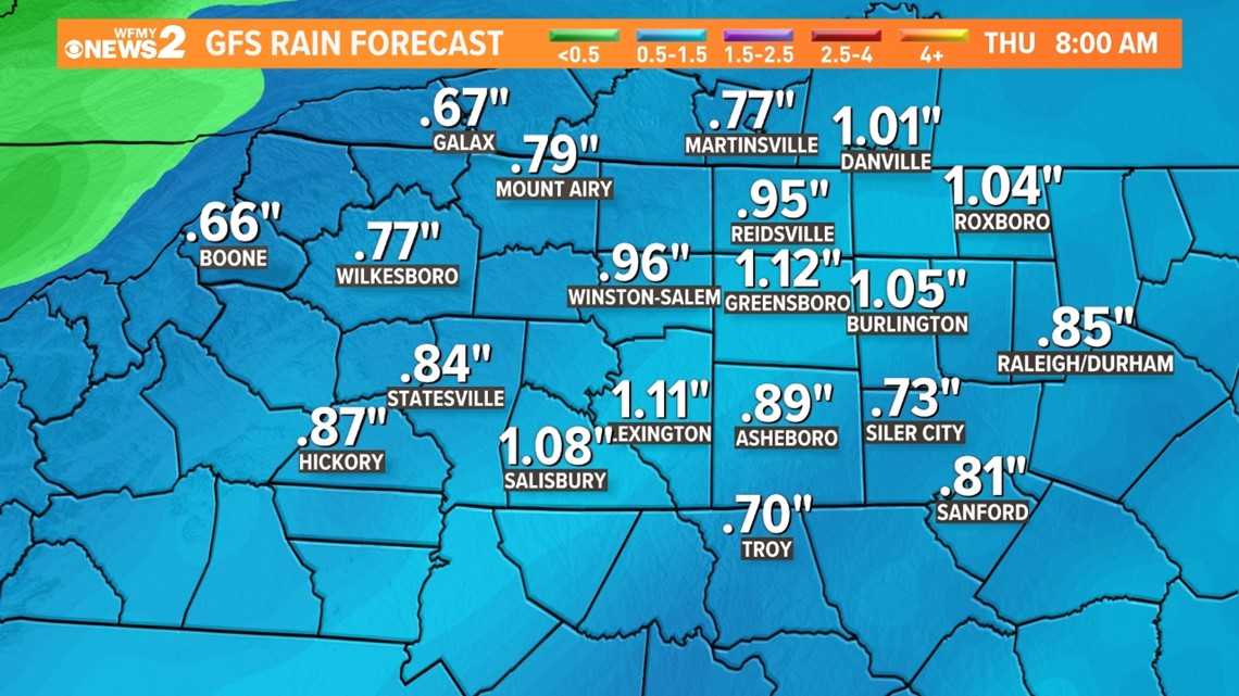
HOW MUCH RAIN?
This system will be another soaker for our area. We are expecting between 0.75" and 1" for most of our cities. That's a large amount, and similar to what we just saw a few days ago on Sunday.
We have been in a wet weather pattern with a new storm system every 3 days of so. That looks to continue for the next few weeks.