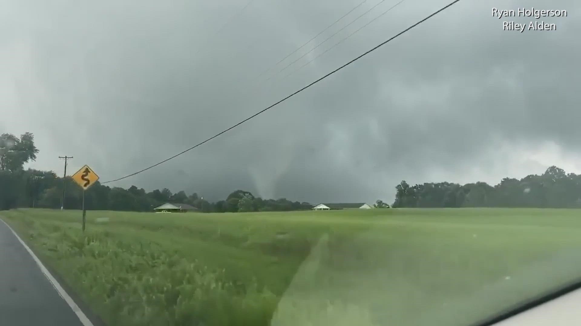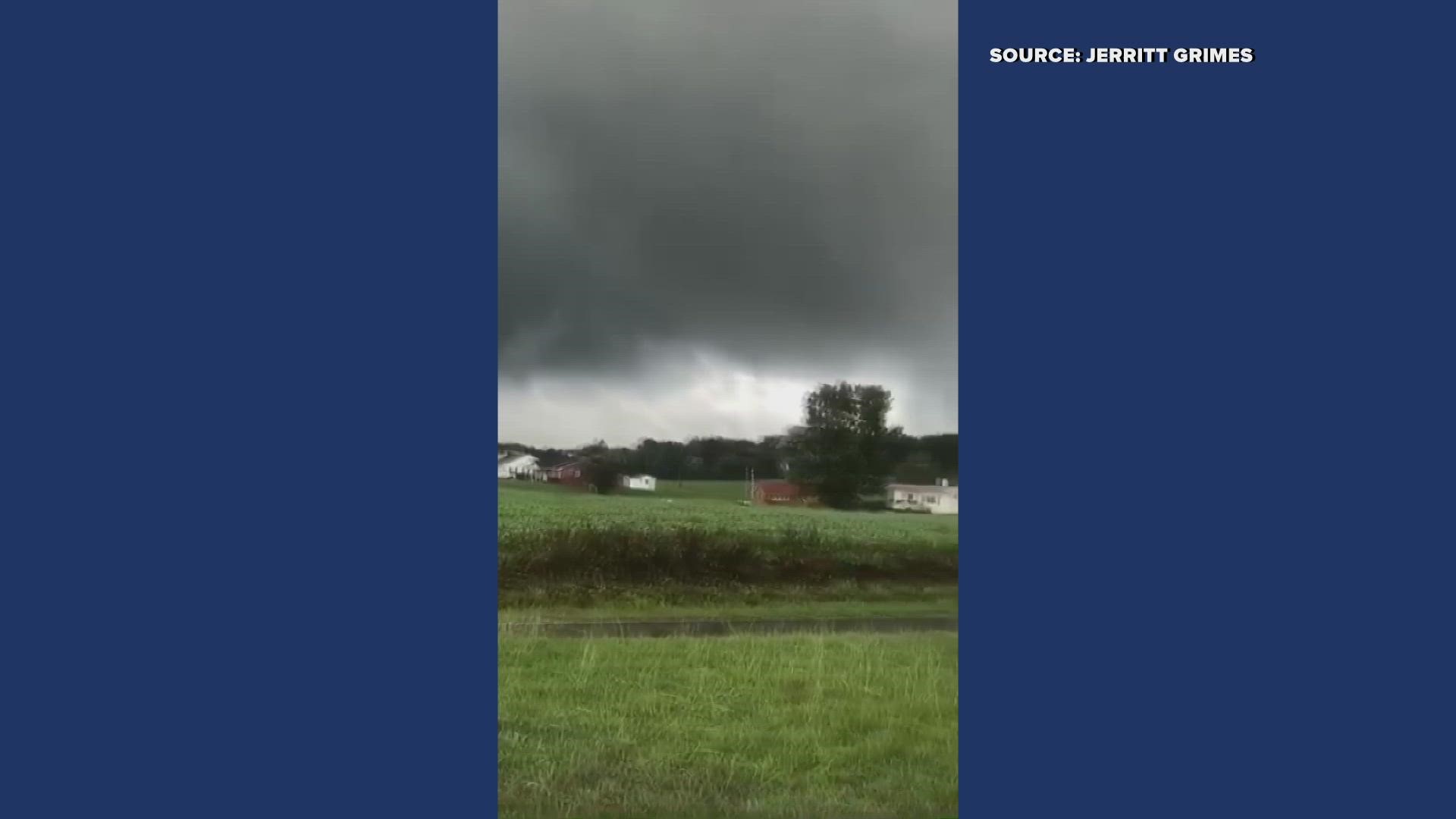
GREENSBORO, N.C. — Fred is bringing big problems to parts of the Carolinas. Tornadoes have already been reported, and more heavy rain and storms are on the way tonight. The WFMY News 2 Weather Team is tracking it for you as the tornado threat continues.
A few more tropical rain bands will continue to rotate through the Triad. These are the ones that will need to be watched most closely for tornadoes.
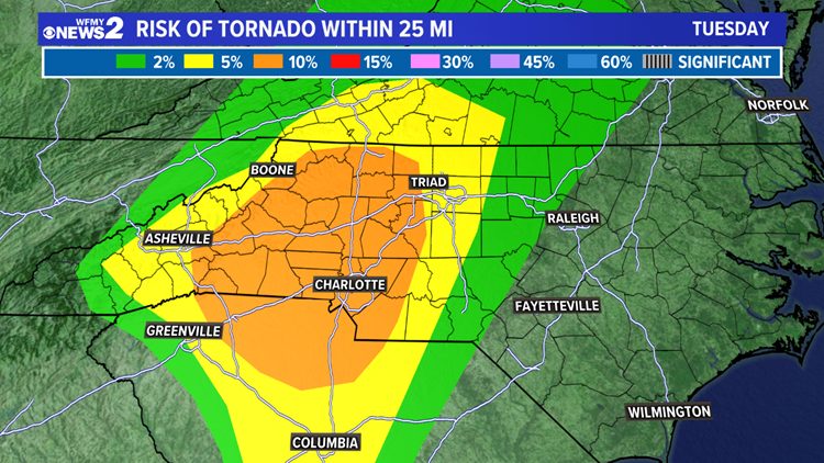
The tornado risk is highest in the Foothills, and a bit lower east of Greensboro.


Make sure you have a way to receive weather alerts while you're sleeping overnight. The WFMY News 2 Radar app can alert you, as well as EAS Emergency Alerts on your cell phone. A NOAA weather radio can also help you.
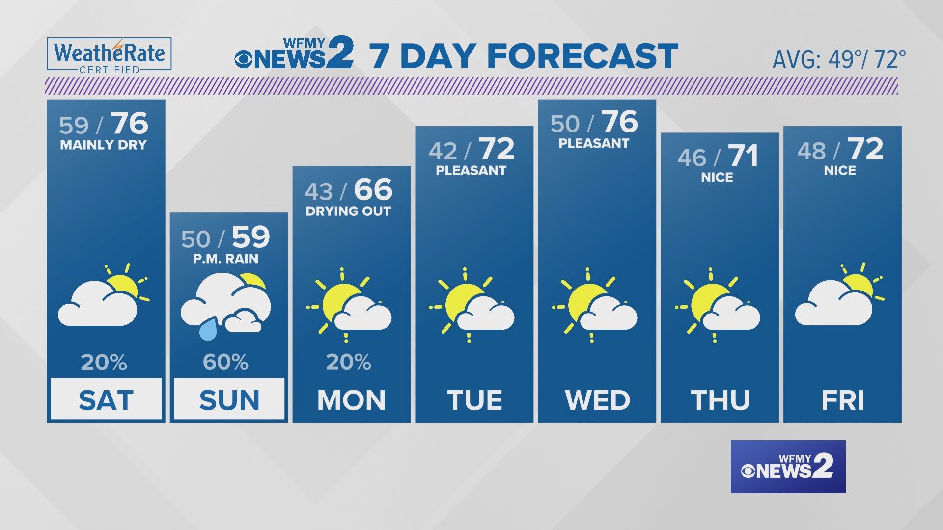
Storm total rain through Wednesday morning could reach 2 to 4 inches for the Foothills. That is enough to cause flooding of creeks, streams, and roads. In most of the Triad, rain totals will range from 1 to 2 inches. In the mountains, over 4 inches of rain will be possible. Higher totals in the higher elevations.
Our last tropical downpours should be winding down on Wednesday morning as Fred moves north of our area. It will get a bit hotter, with highs in the mid 80s. Upper 80s will follow for the rest of the week with a few isolated PM storms.
RELATED: Soggy at times this week