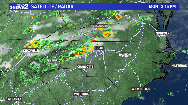
GREENSBORO, N.C. — As of Monday afternoon, a line of storms with gusty winds and abundant lightning are dumping heavy rain in the Foothills. Northern Piedmont is under a severe thunderstorm watch until 8 pm. As this line of storms in the Foothills tracks east-southeast, the environment is conducive for these storms to continue. The main line of storms should dissipate after 8 pm.
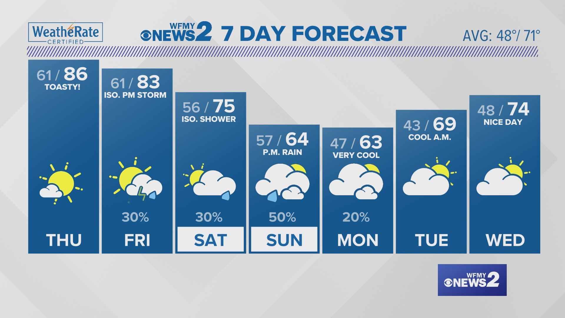
A cold front draped across the mid-Atlantic is helping to spark this afternoon storms. With this boundary not moving much and still within the vicinity of the Triad tomorrow, we can expect storms again late day tomorrow, but they are not expected to be severe.


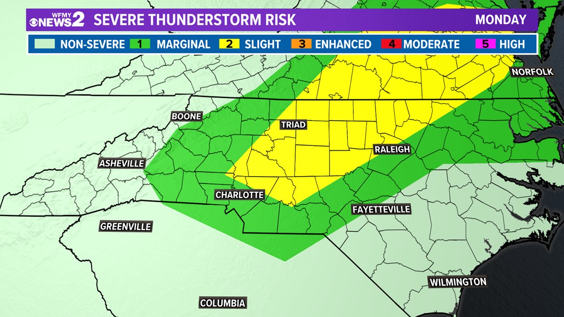
The marginal risk for severe weather is concentrated to the northern Piedmont, so although storms may occur in other locations across the Triad, this area has the greatest likely for having a severe storm potential.

The primary severe threats we can expect to see to with these storms include damaging wind gusts and potential flooding in low lying areas. One of the first severe thunderstorm warnings issued with this line stretching across Alleghany, Surry, Wilkes and Yadkin counties has radar indicated wind speed gusts up to 60 mph.


The rainfall totals across the Triad will range from a trace to .05 inches, depending on where these scattered storms develop and, if training occurs wherein storms develop in the same area of previous ones. Areas of training are concerning sites for flooding. The WPC has us under a slight risk for flash flooding.