GREENSBORO, N.C. — It's going to be a messy end to the weekend. Colder temperatures have arrived with lots of rain. Wind gusts will need to be watched today as they may gust between 30-35 mph. There could be a few wet snowflakes in the Triad at times. There is a lot to talk about and our WFMY News 2 Weather team is on top of it.
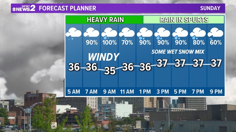
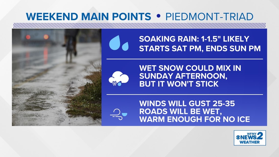
We will see a wet, windy and chilly day. Temperatures will hold in the mid and upper 30's through tonight. the heaviest rain will be this morning, then become more of a scattered showers pattern midday and afternoon. the rain will taper off this evening. Rainfall amounts of and inch or more are possible.
By this afternoon, cold air will be wrapping around on the back side of the storm system. That's when we'll have at least the chance of some wet snow showers mixing in with the rain. At this point, it's just a possibility. The better chance of snow will be in the Foothills and Mountains.
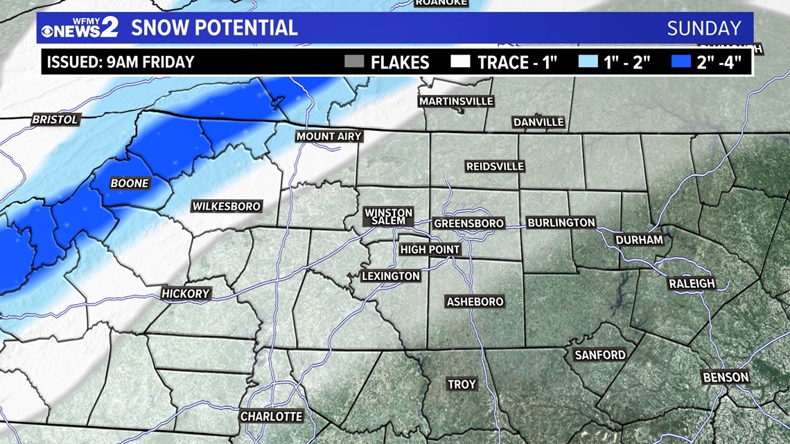
Accumulation is not expected here in the Triad. A light amount of snow may be possible in the Foothills, with several inches in the NC Mountains.
WHAT'S THE TIMING?
This is mostly a Sunday system.
- Sunday Morning: Cold Rain. Temps low 30s.
- Sunday Midday: Cold Rain Continues. Temps mid-30s.
- Sunday Afternoon: Cold Rain, But Wet Snow Bursts Possible. Temps mid-30s.
- Sunday Evening: Rain and Wet Snow Ending.
- Sunday Night: Clearing. Low 34. Roads Mainly Wet.
WHO GETS SNOW?
Let's repeat. Snow isn't very likely to accumulate here in the Triad. In fact, it's only a chance that we'll see any flakes mixing in at all.
We aren't forecasting any accumulation in the Piedmont-Triad area. It varies as you head west though. This is the type of storm that elevation will play a very important role in snow sticking.
The NC Mountains will get several inches of snow, especially on the peaks. Valleys and the Foothills will get lower totals.
Our latest snow forecast map is below:

STORM IMPACTS:
The main impacts of our storm system will be rain and wind.
- Rain totals will be impressive, around 1 to 1.5 inches for most of us
- Minor flooding and ponding of water are possible on Sunday.
- Wind gusts of 30-35 mph will be likely Sunday morning
- Power outages aren't likely, but a few can't be ruled out with gusty winds
- Any wet snow showers will not stick on roads or cause travel problems
- Roads will stay wet with temperatures above freezing. Icy roads are not expected.

KEEP IN MIND:
The storm will be different in different areas. The NC Mountains are in line to get a good thumping of snow with the system. In the Foothills, there is a better chance of wet snow mixing with rain. Here in the Triad, that chance is a little lower.