GREENSBORO, N.C. — Significant amounts of freezing rain added up to around 1/4" in the Triad or even more further to the north this morning. That amount of ice was enough to bend and break many tree branches and uproot some big trees. As of 9 PM over 50,000 people are still without power in Guilford county.
This ice fell on top of what already was left over and didn't melt from Friday morning, making for a dangerous situation Saturday morning.
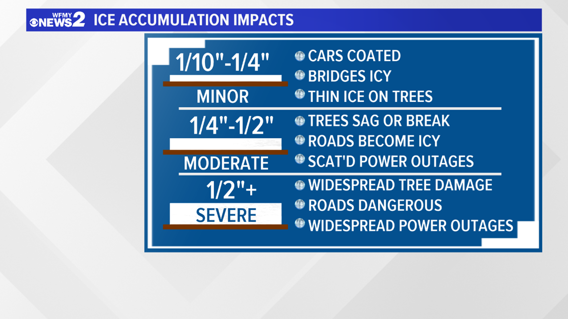
South of I-40, there was still a glaze of ice in the trees and some slick spots, but no major issues. This was one of the most major icing events for the Triad in several years, likely the worst since 2014.
We reached that 1/4" to 1/2" of ice threshold this morning which is when ice really starts to cause issues weighing down trees, power lines, and making for slick roads and bridges. Even though the freezing rain had ended by lunchtime, many folks still heard what they described as "gunshots" or "booms" as trees cracked and fell under the weight of the ice and saturated ground.

You can view a video forecast from Meteorologist Christian Morgan below:
TIMELINE:
Overnight, there could be slick spots, especially on bridges as temperatures drop back to near or just below freezing. Darkness makes it easier for ice to accumulate without sunlight to help it melt. A lot of the ice that accumulated on trees Saturday morning still did not melt off, meaning branches and trees are still weighted down by ice and could fall and cause more power outages overnight or make impassible roads.

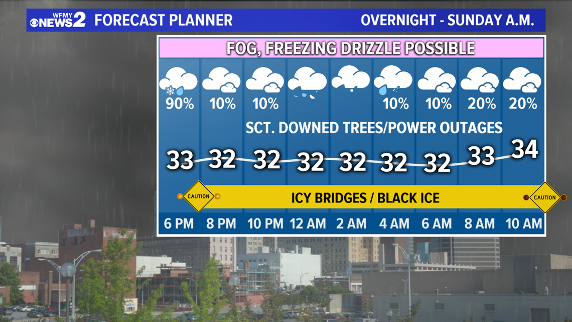
During the day Saturday, temperatures will be slow to warm. However, as our cold air pulls away, it's likely that we will eventually rise to 32° / 33°, allowing this event to end as rain during the afternoon. Travel conditions may improve midday/afternoon. Roads could again become slick overnight Saturday into Sunday morning.

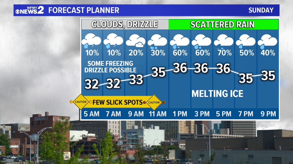
During the morning and midday hours on Sunday, we're mainly dry but still cloudy and cold. Temperatures should warm well above freezing and melt away any ice left on the trees.
By afternoon and evening, more rain will be arriving in the Triad which can also help melt ice if it's warmer and falls at a faster rate. This will stay just regular rain, so no travel issues are expected Sunday night.
We still have a couple more days with rain to go before we get a break and some sunshine, but after early Sunday morning, it doesn't look like we'll need to worry about icing issues for a while.
The WFMY News 2 Weather Team will keep you updated on-air and online.