GREENSBORO, N.C. — We're under a Winter Weather Advisory as we head through the afternoon and evening. Even though the morning didn't have much to offer in the way of snow, a mix of snow, sleet and rain is still possible this evening as the second part of our system, an upper level low swings through the Triad. It's slow moving, meaning we'll still have a good chunk of time to see some snow in the area. Some spots will still have the chance for some accumulation.

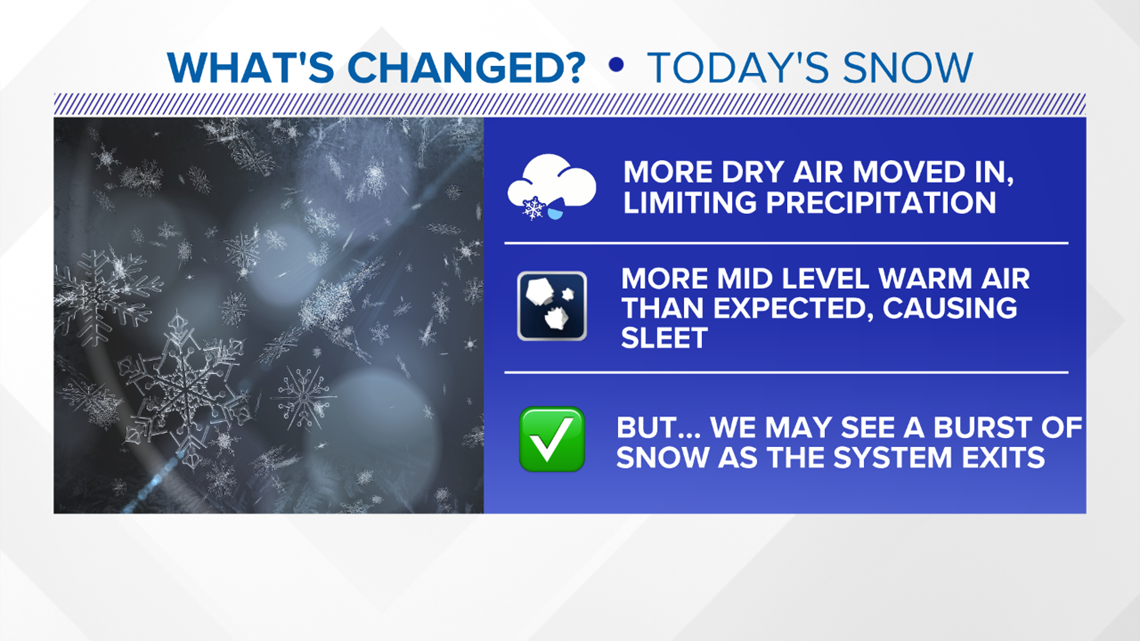
So, what has changed with our system? A lot of dry air got worked into the system early on this morning which made it hard for precipitation to fall. The atmosphere in a way, works like a sponge. Because in order to overcome the dry air, any precipitation that's falling has to saturate the dry air in order to make it down to the ground. That's why it was more patchy this morning and not as steady. Also, warmer air caused more sleet than expected which really cuts down on snow.
WHAT'S COMING?:
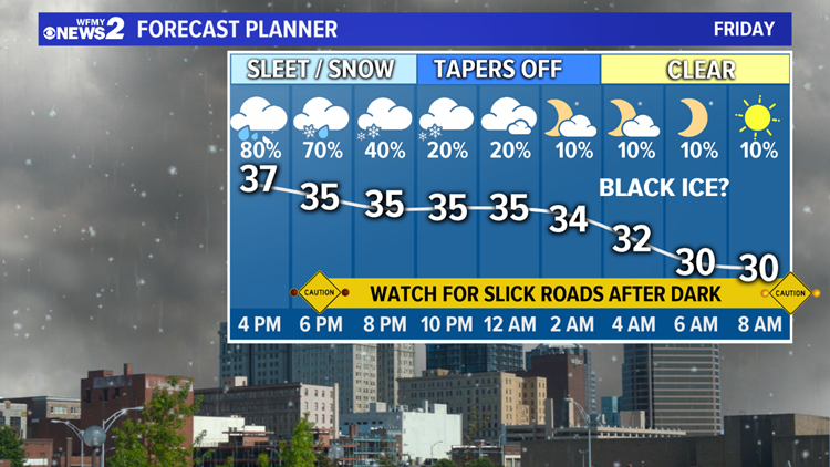
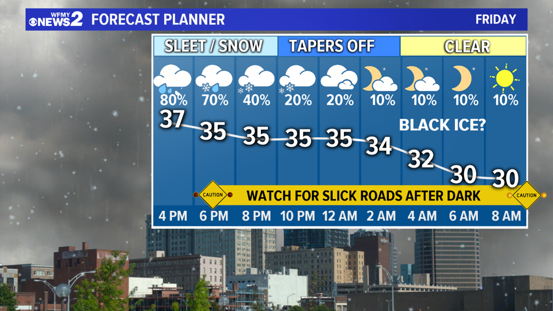
Temperatures won't be terribly cold, but they should be just cold enough to allow for periods of snow & sleet will mix in with rain in much of the Triad as the upper level low swings through. A burst of snow will be possible through about 8-9 PM, then tapering off overnight.
As sleet and snow taper off, temperatures will drop below freezing tonight. After dark, some slick spots on the roads will be likely. Black ice will be possible for Saturday morning. Skies will begin to clear out heading into Saturday.

WHO GETS WHAT:
- In general, the farther north and west you are - the better your chance for heavy, wet snow you'll have this evening, and better chances for accumulation. There are already some spots that have enough to cover the ground. The farther south and east you are - the lower your chance of that.
- Here's what we're thinking:
- Mix of snow, sleet and rain: Much of the Triad and the I-40/85 corridor including Greensboro, High Point, Burlington, Lexington, and Asheboro for the rest of the evening.
- Mostly rain, with some flakes: South of Asheboro
- How much snow accumulates in your neighborhood will depend on who gets some localized heavier bursts of snow. Some areas may get around 1" while most folks south of the Triad won't see more than a dusting tonight.
TIMING:
- Bursts of snow possible Friday evening as the system pulls away. Accumulation is possible, around 1" for most Triad areas.
- Drying out Friday evening/overnight.
- Dry, but icy roads possible Saturday morning
WHAT TO DO:
- Plan on slick roads in spots and possibly difficult travel especially in higher elevations through Friday evening, with a re-freeze likely for Saturday morning.
- It would be a good day to work from home if you have the option
- Get your shovels and ice melt ready to go to clear sidewalks and driveways.
- Heavy, wet snow could weigh down trees and power lines in some areas.