
GREENSBORO, N.C. — We're on the lookout for storms this afternoon. Rain would be beneficial, but a few storms could turn strong to severe as they form during the afternoon and evening hours. Here's what the WFMY News 2 Weather Team is tracking.
A cold front will be moving toward the Piedmont this afternoon and tonight. As the front gets closer this afternoon, we could see a few showers and thunderstorms spark, some of which could be strong to severe.
► Download the WFMY News 2 App: Apple Users, Android Users
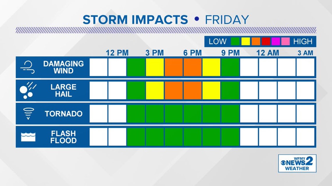
The main time frame to keep an eye on will be between 3pm and 7pm here in the Triad areas. It's during that time that storms could form, and some of them could pack a punch with some damaging wind gusts or some large hail. There isn't a large tornado or flooding threat with this particular system, but of course we'll keep an eye on it for you.
Here's a timeline and possible threats:
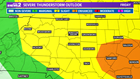
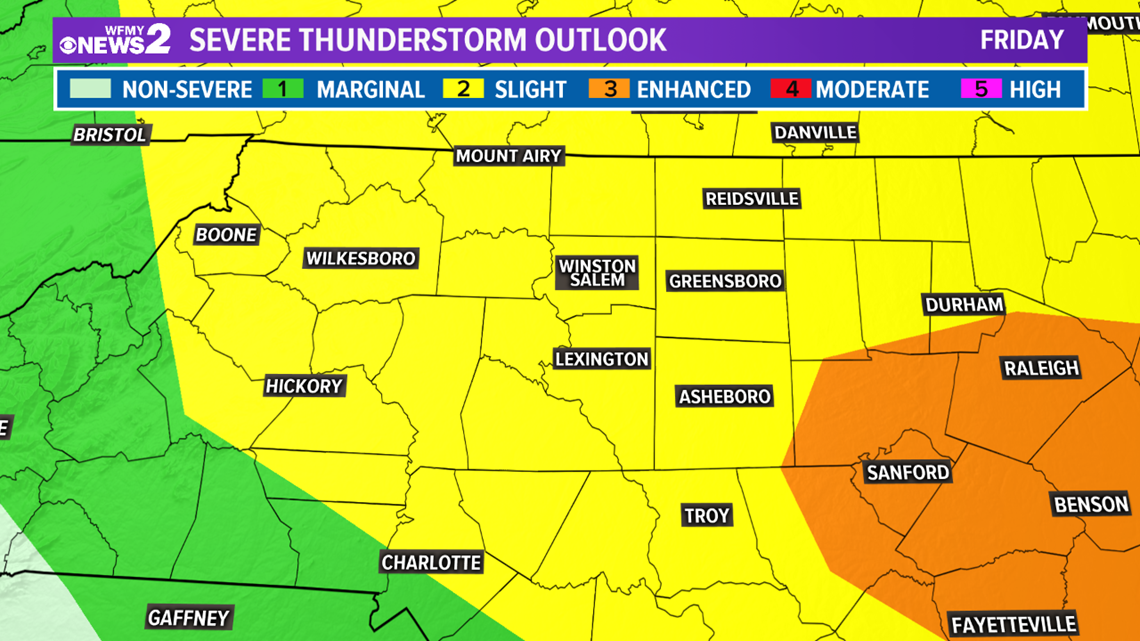
Storms will be wind down by late evening for any Friday night plans, with clearing skies taking over after that. A slightly cooler weekend is on the way with highs in the low to mid 80s. All of central North Carolina is in the slight risk category. Further East towards the Sandhills there is an enhanced risk.
► Download the WFMY News 2 App: Apple Users, Android Users