
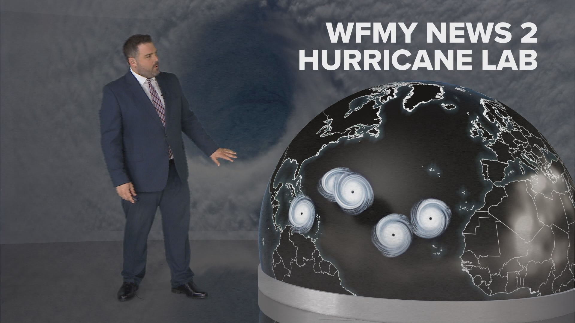
GREENSBORO, N.C. — Hurricane season is just days away, and the official predictions are out from the experts. The WFMY News 2 Weather Team is following the official NOAA Forecast.
What's the forecast?
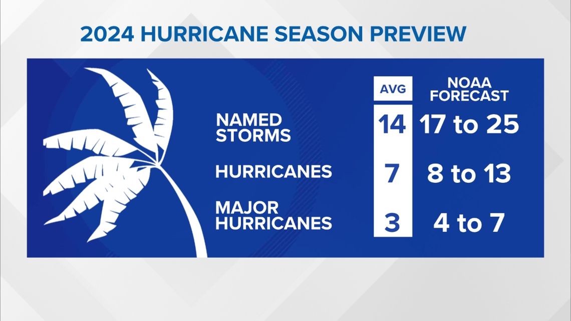
The forecasters at NOAA are predicting more storms than usual this year.
As expected, the forecast calls for a very active 2024 Hurricane Season. 4 to 7 Major Hurricane are forecast. These are category 3 (sustained winds of 130 mph) or higher. View the video in this story as Chief Meteorologist Tim Buckley explains the reasons behind the expected active season.

What causes hurricanes in the first place?
Before we dig into the forecast it's important to understand how they form in the first place. Hurricanes are ocean storms. They get their energy from the ocean. Specifically, they get their energy from warm water.
To develop tropical storms and hurricanes, water should be at least 80 degrees warm for a depth of 150 feet. That's a requirement, but it's not the only thing you need to produce a storm.
You also need to have an existing weather system. Warm water won't create a storm out of thin air. Ideally, you want to have a cluster of thunderstorms or a small area of low pressure. Typically, this may drift off the coast of Africa and over the Atlantic Ocean. We call these 'tropical waves'. If they roam to an area with warm water, they could potentially grow into a tropical system. But there's one other key thing you need.
The winds in the atmosphere have to be favorable. Tropical systems need to have fairly light winds in the atmosphere. To put it another way, you don't want strong winds that change with height that could rip a storm apart. We call this wind shear. You want low wind shear, or weak / uniform winds to create a tropical system.
To sum it up, you have to have warm water, a cluster of storms, and favorable winds to get a tropical system going.
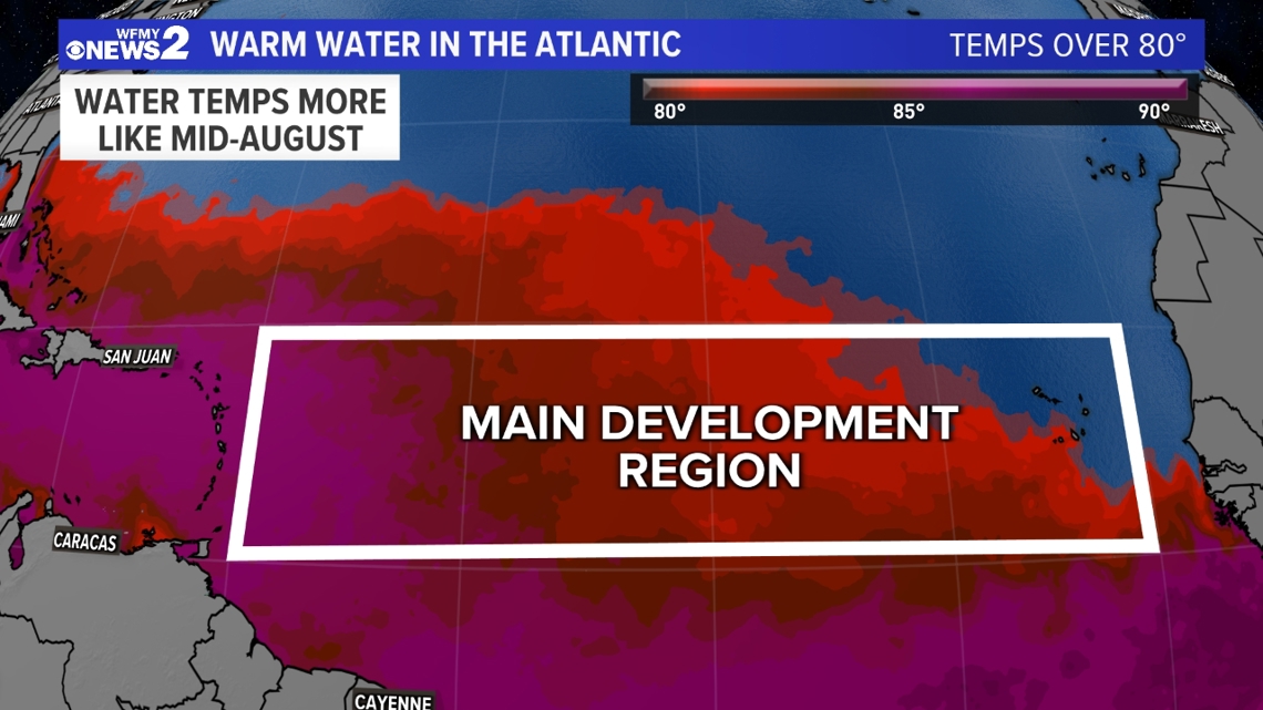
The ocean is really warm already this year
We keep track of the Atlantic Ocean sea surface temperatures using satellites. Right now, the ocean temperatures are looking above average in most locations.
Unfortunately, they're looking way above average. This warmer water provides a lot of extra fuel to work with before hurricane season has even begun.
There's one part of the ocean we look at more closely, called the "Main Development Region" located between Africa and the Caribbean. This is the zone many powerful hurricanes usually get their start before they head to the Carolinas. In this area, much of the water is already 80 degrees or warmer. That's more typical of August than May, and gives us cause for concern.

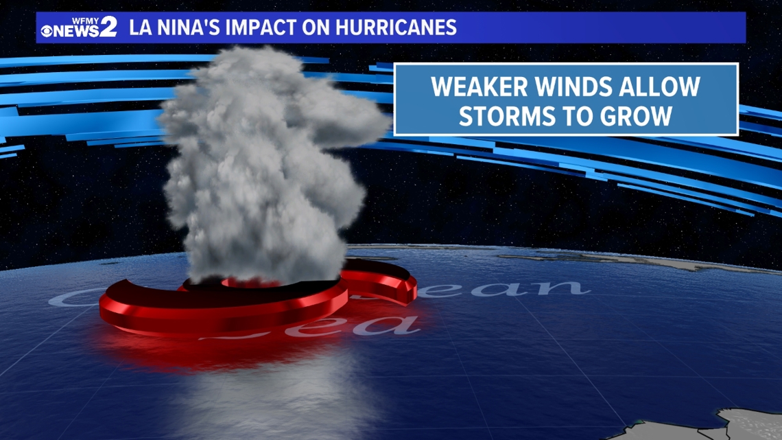
A La Nina is expected to develop this year
When we forecast a new season, you'll often hear us talk about an El Nino or a La Nina. These are weather patterns that develop depending on the the water temperature in the Pacific Ocean.
Why are we talking about the Pacific Ocean for an Atlantic hurricane outlook? Well, weather is all connected.
In an El Nino year, with warmer Pacific Ocean water, the winds are usually harsher in the Atlantic Ocean and can tear apart tropical systems more easily. This can suppress hurricane development leading to fewer storms than usual. That's the pattern we had last season, and we still had more storms than average.
This year, El Nino is fading away, and a La Nina is expected to develop. That means cooler than average Pacific Ocean water, which can relax the upper level winds in the Atlantic, leading to less wind shear. Remember, less wind shear can make it easier for tropical systems to develop.
We are expecting a La Nina pattern to make it earlier for hurricanes to form in the Atlantic this year.

Keep in mind...
Even in an active hurricane season, we don't know where storms will end up. In 2023, the Atlantic Hurricane Season was more active than usual but most people probably didn't notice. Why? Most storms turned out to sea before impacting the United States.
It is next to impossible to predict months in advance who will get hit by hurricanes for the upcoming year.
We are saying more storms than usual are likely this year. We aren't saying if they will hit North Carolina or not.
Remember, it only takes one. It's good to be ready and have a plan in case we get in the line of the storms that pop-up this year.