

GREENSBORO, N.C. — Severe storms aren't a guarantee, but there is a chance that some rough weather could move into the Piedmont tonight. The WFMY News 2 weather team is tracking it for you.
A backdoor cold front moved across the area this morning and set up a wedge of cooler air. That's helped us out so far today.
At the same time, a very strong storm system will be moving our way from the west. This system brings a threat of severe weather across Tennessee, Georgia, and into the Carolinas tonight
Severe storms aren't a guarantee for us. It will depend on if the cool air hangs on, or, if the warm / muggy air moves in. If we do warm up, a few severe storms are possible. We'll need to watch for damaging winds and big hail if so, with a low tornado threat too.
TIMELINE:
- 7pm - 12am Saturday: Best chance for a few thunderstorms. Some could be severe during this time
- 12am - 4am Sunday: Any storms or rain coming to an end.

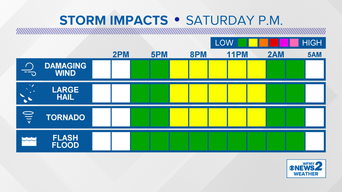
WHERE IS THE THREAT?
All of the Piedmont needs to be on the lookout for a few possible severe storms tonight but they aren't guaranteed. The better chance though will be in the southwest part of the state.


Make sure to have your WFMY Radar app downloaded with alerts turned on. Follow WFMY on Facebook, Twitter and online throughout the day to stay up to date on the weather.
Have a plan in place for your family in case a severe thunderstorm warning or tornado warning is issued for your area.