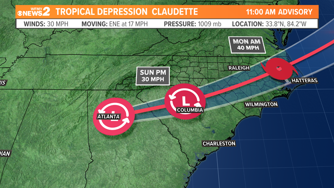
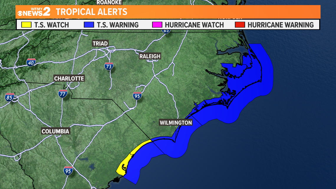
At 11 am Sunday Tropical Depression Claudette is 15 miles east-northeast of Atlanta, Georgia, and tracking to the east-northeast at 17 mph. winds have weakened to 30 mph. Claudette will move across Georgia today and South Carolina tonight. Claudette is expected to gain strength Monday and is expected to become a Tropical Storms again and will move off the North Carolina coast late Monday. Tropical Storm Warning have been issued for portions of the North Carolina and South Carolina coast.
FORECAST TRACK:


POTENTIAL RAIN:
Rainfall potential in the Deep South states is significant, where between 4 and 6 inches is expected. Here at home, we're more likely to be on the northern edge of the system where lower totals are more likely.

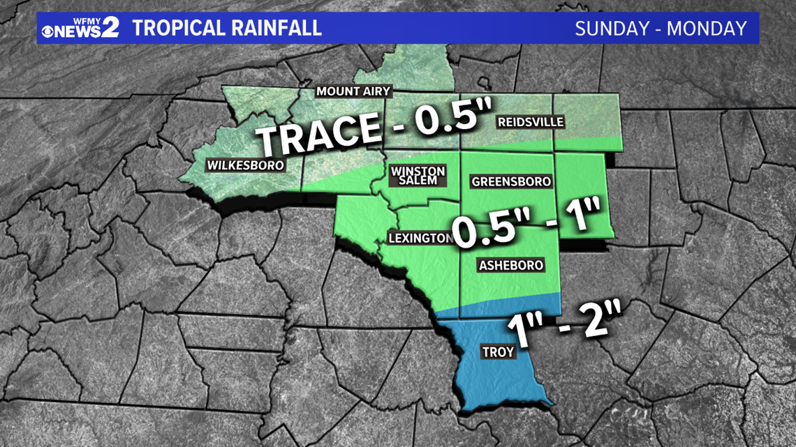
This could still change. If the center of the storm moves over us, 1-2 inches will be possible.
Additional rainfall from a cold front on Tuesday is likely.
Flooding may become a concern for areas to the south on Sunday afternoon and evening.


TIMING & IMPACTS IN THE TRIAD:
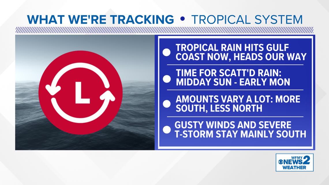
At this point, it looks likely that we will feel some effects from this storm, but we'll be on the weaker northern edge.
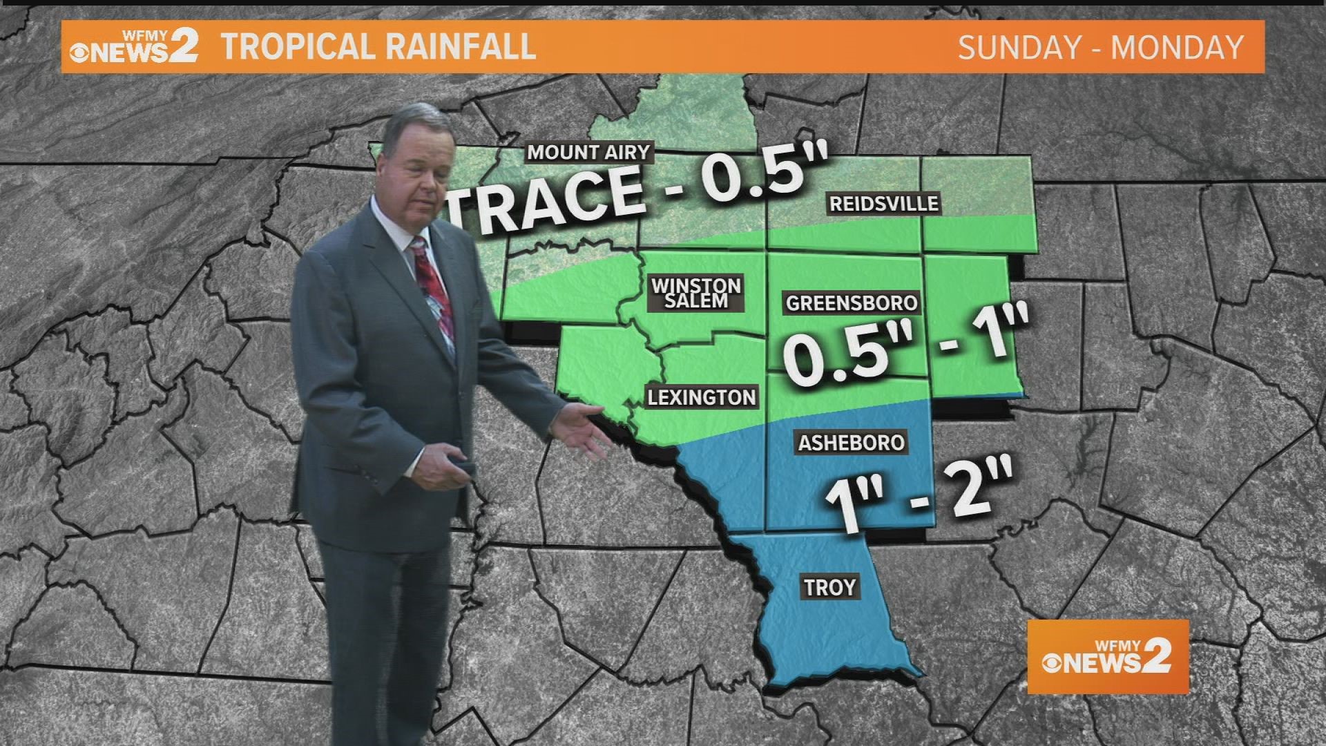
If you have plans on Sunday, be prepared for some scattered downpours to start as early as midday. More widespread south of I-40, less widespread north of I-40.
For Monday, we're looking at the system passing by. Scattered downpours will be possible for the morning hours, but drying out by midday and the afternoon.
- Rain totals as little as a trace to 1/2 inch north of Greensboro. Rain totals as much as 1-2 inches areas well south of Greensboro.
- Wind gusts of 20-35 mph will be possible
- Risk of severe thunderstorms or tornadoes is very low and not expected for our area