
GREENSBORO, N.C. — Damaging winds brought destruction to a large part of Guilford County and the Piedmont on Tuesday. Since then, we keep hearing one question over and over, "Was it a tornado?" We turn to the WFMY Weather Team experts to help clear this up.
What's the difference between a tornado and straight-line winds?
"You don't need to have a tornado to have incredibly destructive winds," says WFMY Chief Meteorologist Tim Buckley. He says it all comes down to how the wind is moving, not how fast it is.
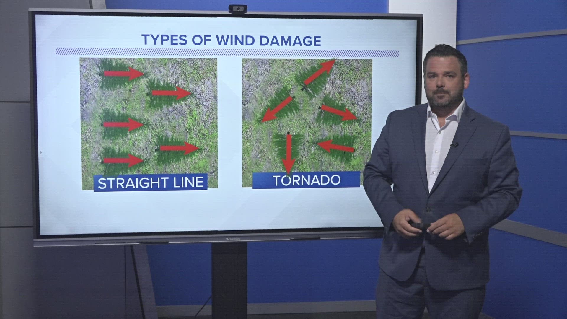
A tornado has winds that are rotating. This means the air is spinning in a counter-clockwise way, usually at very high speeds of 80-200 mph.
A severe thunderstorm can sometimes produce what we call a microburst, otherwise known as straight-line winds. This happens when a downburst of wind rushes out of a storm, hits the ground, and races out in one direction. Microbursts can produce winds of 60 - 150 mph over a small area.
Often times after a storm rolls through an area, the National Weather Service will go to the storm damage and investigate. If the fallen trees are all facing one direction, it's likely from a microburst. If the fallen trees are in a swirling pattern, that likely indicates a tornado.
"This was a microburst, not a tornado"
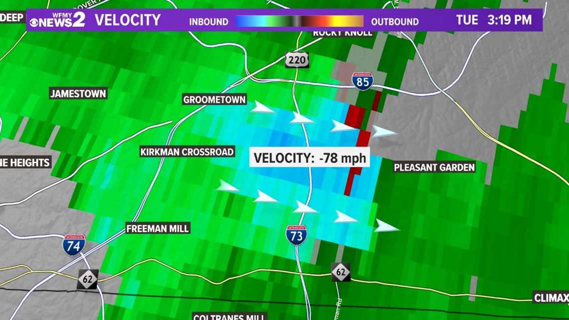
So which was it on Tuesday? The damage on the ground and the radar both tell the same story.
"This was a microburst, not a tornado," says Buckley. "The winds were all blowing in the same direction at hurricane-force speeds."
The image below shows the motion of these high winds. If it were a tornado, we'd see winds moving in the other direction as well. Instead, you see that bright shade of blue indicating a west-to-east wind across southern Guilford County.

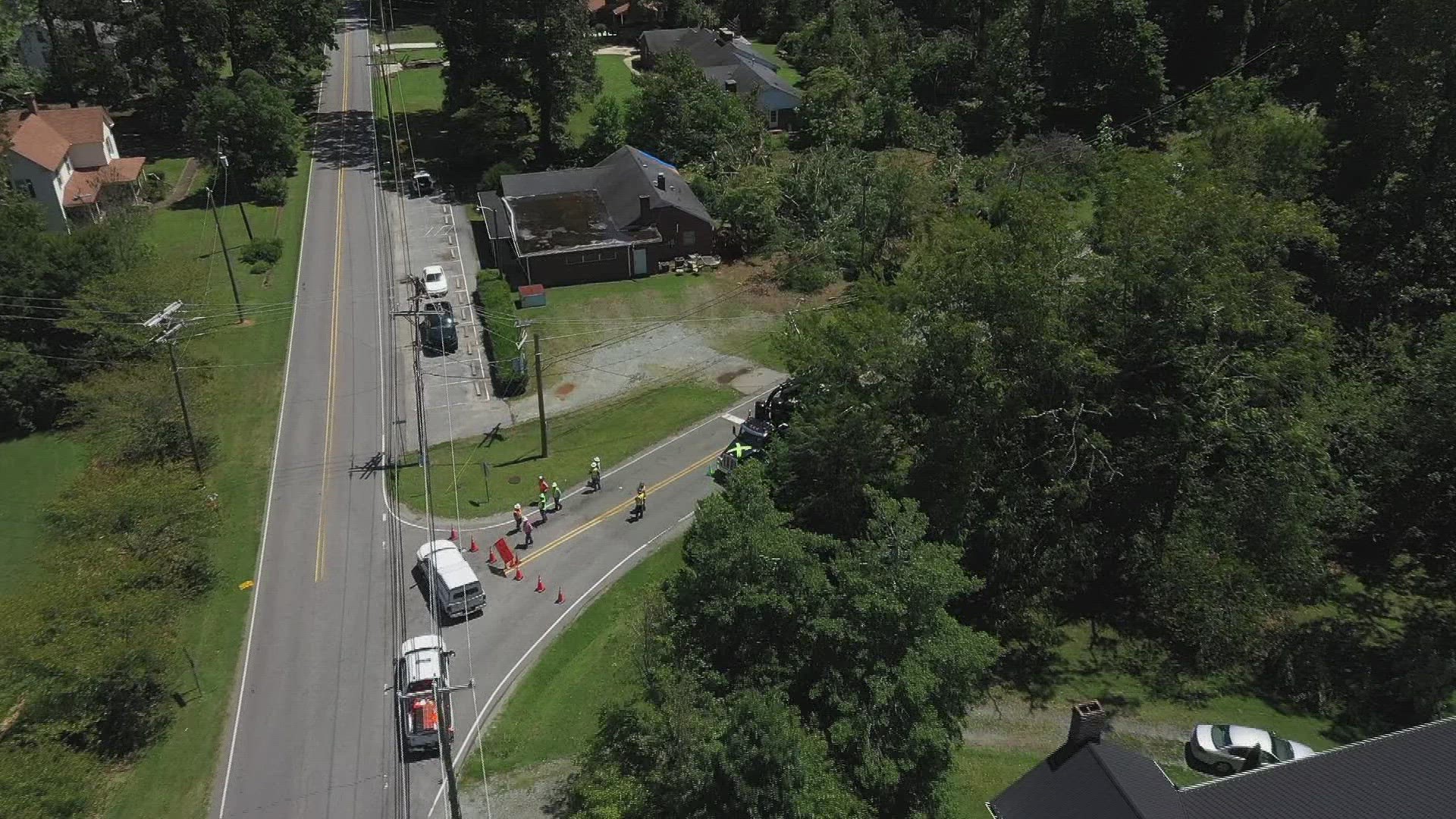
On the ground, trees are mostly all facing the same direction. Falling toward the east from the winds that came out of the west. You can see that in the video below:
What was the storm's path?
A Severe Thunderstorm rolled through many counties in the Piedmont. It started in Davie County near Mocksville, bringing wind and hail.
It then moved into northern Davidson with more high winds, rain, lightning, and hail. It intensified as it entered Guilford County.
High Point, Sedgefield, Jamestown, South Greensboro, and Pleasant Garden saw the worst of the damage as the storm plowed east with near hurricane-force wind gusts. From there, the storm moved into southern Alamance County before exiting our area.
MORE WAYS TO GET WFMY NEWS 2
Subscribe to our daily newsletter Let’s Get 2 It!
Download the WFMY News 2 APP from your Apple or Google Play store.
ADD THE WFMY+ APP TO YOUR STREAMING DEVICE
ROKU: Add the channel from the ROKU store or search for WFMY.
Amazon Fire TV: Search for WFMY to find the free app to add to your account. You can also add the app directly to your Fire TV through your Amazon account.