GREENSBORO, N.C. — Strong to severe thunderstorms are possible through this Friday evening. Not only that, but high winds are likely for all of us. You'll want to be prepared and have a weather plan ready to go.
The WFMY News 2 Weather Team is on top of it and will have you covered.
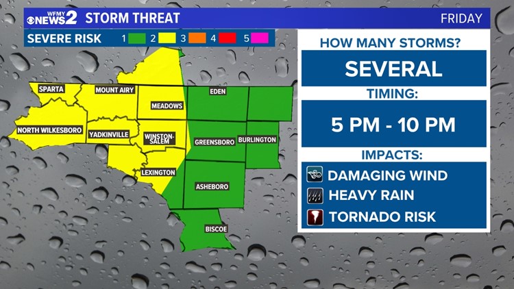
A strong cold front is moving across the south on Friday. This brings a threat of high winds and severe storms from Texas to the Carolinas. For us, we're really going to be watching the afternoon and evening timeframe today, between 4pm and 10pm. That's when warmer air will be getting closer and the cold front will start to arrive. Storms could form ahead of this front and create damaging wind gusts or even a tornado.
TIMELINE:
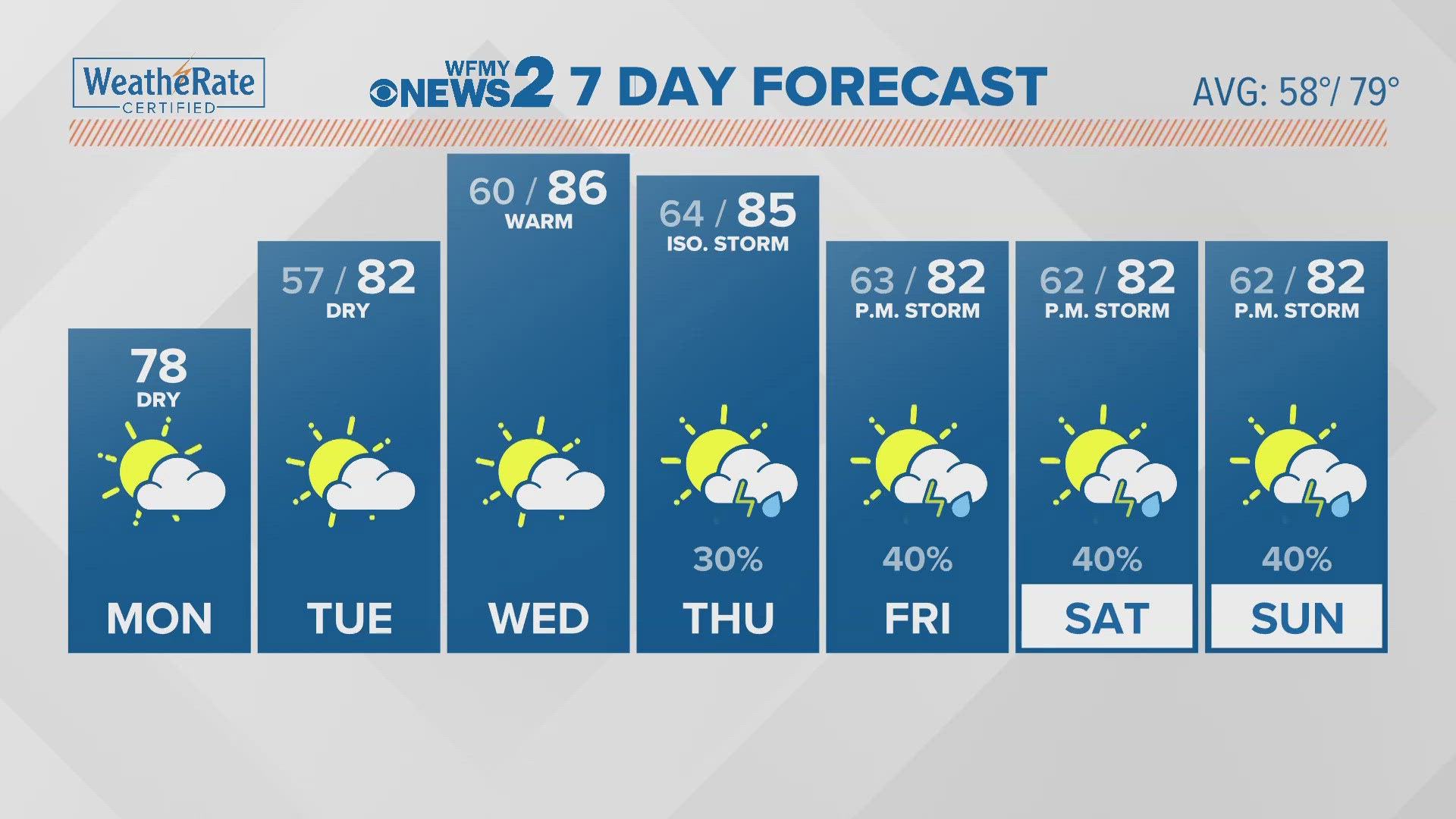
- Friday afternoon: Warming up. Temps mid 60s. Stray shower.
- Friday 4pm - 10pm: Gusty winds of 30-40 mph likely for all. Strong t-storms moving in. Some could be severe. Low tornado risk.
- Friday Overnight / Saturday morning: Winds weakening. Drying out. Low 40s.
- Saturday: Sunshine. Breezy. High temps near 60.


GUSTY WINDS FOR ALL:
With this system, only some thunderstorms will form. So, they'll be scattered. That means that not all of us will have a bad storm. However, high winds will be an issue for everybody.
Gusty winds will likely be between 30 and 40 miles per hour late Friday afternoon into Friday evening for everybody.
It's a good idea to secure loose outdoor objects or stack lawn furniture. Anything that can blow away probably will.


TORNADO RISK:
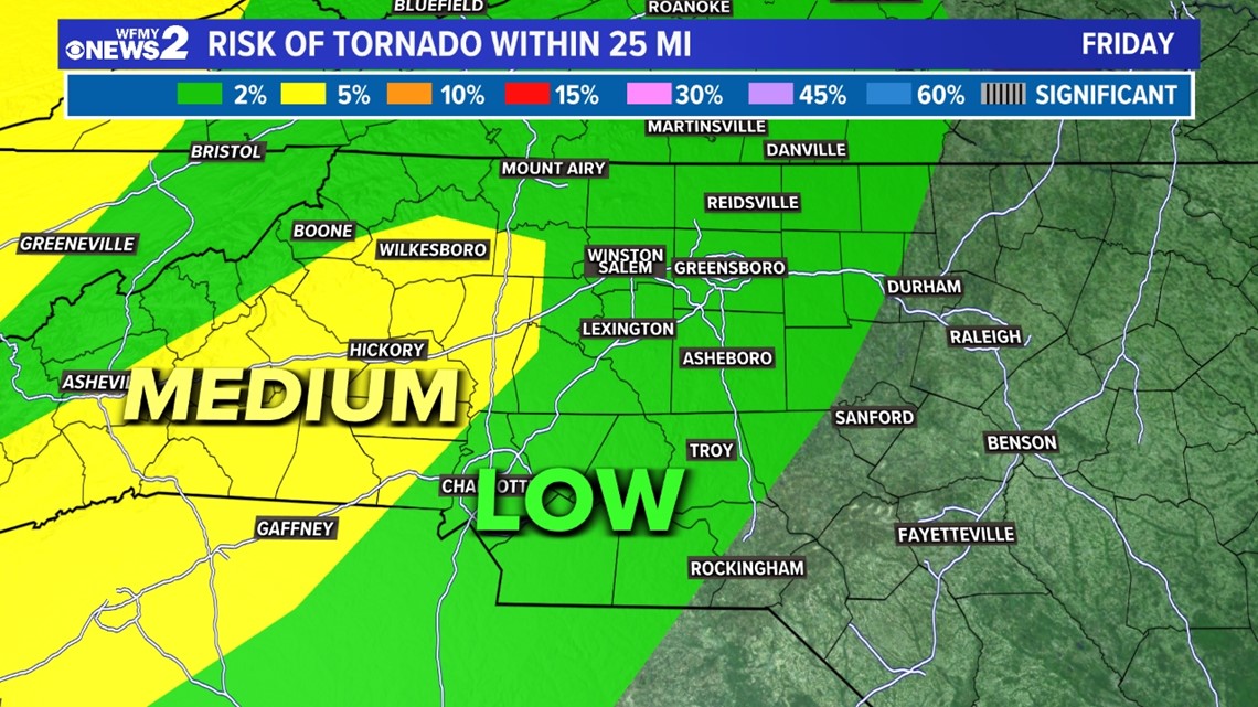
With this cold front moving in, there is a tornado risk. It's higher as you go west closer to the center of the storm.
There will be a moderate / medium risk of tornadoes in the mountains and points west. For us here in the Triad, we'll have a low threat of tornadoes.

MAIN POINTS:
Bottom line, we have some strong weather moving our way. It will bring us gusty winds across the whole area, and a line of strong to severe thunderstorms that will hit some of us, but not all.
It's a good idea to secure outdoor objects, have your devices charged up and your alerts turned on.
If a tornado warning is issued for your area, get your family to a safe place away from windows and exterior walls. Keep an eye on the forecast from WFMY News 2 and download our mobile app to your phone. If a tornado warning is issued we will broadcast live until it is over.